


Oil and ice: ADAC engineers prepare for spills in the Arctic
by joey |

ADAC engineers researched how much oil could get trapped under ice in the event of a potential Arctic oil spill. (Image courtesy of Pixabay)
What does the underside of sea ice look like? Until recently, no one really needed to know. But now, with Alaska oil drilling on the rise, the threat of spills in ice-packed waters has increased. Suddenly, the underside of ice matters.

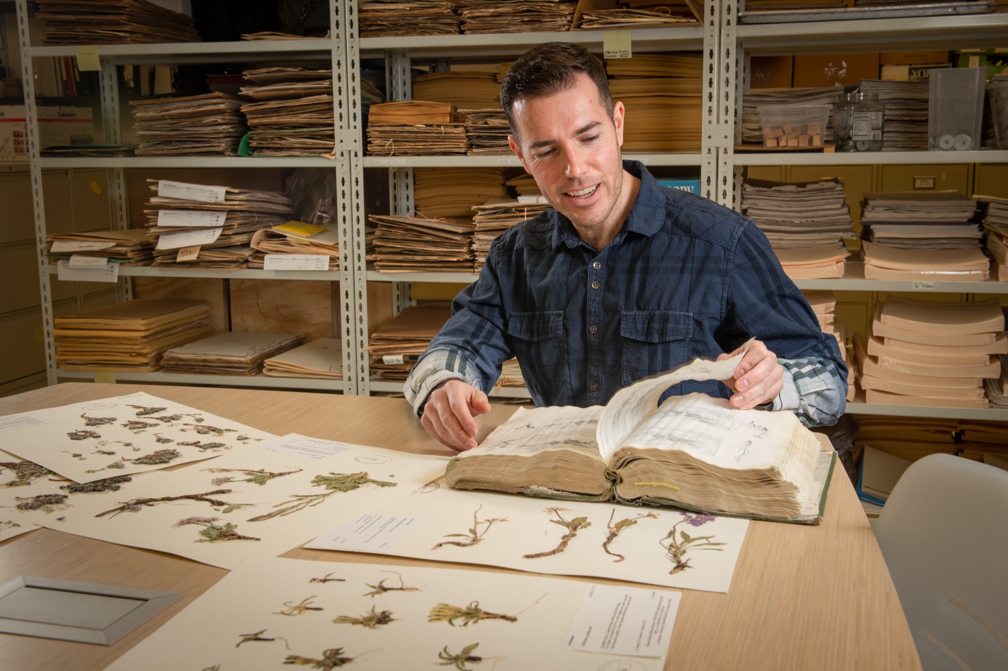
Arctic Domain Awareness Center Workforce Development Fellow Kelsey Frazier discusses her project "Oil Beneath Sea Ice: Predicting Storage Capacity as a Means to Better Anticipate Oil Slick Spreading" at the poster presentation for UAA's 14th Annual Undergraduate Research & Discovery Symposium in the spine. (Photo by James Evans / University of Alaska Anchorage)
For the past five years, a UAA engineering team explored how ice and oil might interact in Arctic waters, and their results are already changing the U.S. Coast Guard's response plan. Among that team is Kelsey Frazier, a mechanical engineering graduate student and ADAC fellow at UAA.
ADAC, or the Arctic Domain Awareness Center, is a federal research center housed at the University of Alaska, funded by the U.S. Department of Homeland Security. The center works to provide federal agencies, primarily the U.S. Coast Guard, with information to protect communities and economies in icy areas. Current projects stretch from the Arctic Ocean to the Great Lakes.
Kelsey is part of the Arctic oil spill modeling team, exploring how a spill might spread in an Arctic environment.
"There's so much interest to drill out in the water on the north coast of Alaska, and the concern is we have a limited Coast Guard presence in the area," Kelsey explained of her research, and its immediate implications: "We're trying to develop the science and technology that our first responders are going to utilize in the next year to the next 10 years."
For massive oil spills, the Coast Guard typically turns to the National Oceanic and Atmospheric Administration (NOAA) for data, specifically the Office of Response and Restoration. NOAA has models - based on currents, wind speeds and more - that determine where oil might move in water. But ice wasn't part of that equation until now.
"Before we started working on this project, our country had no basis for predicting the trajectory of oil in an Arctic environment," said Tom Ravens, Kelsey's engineering advisor and the principal investigator on ADAC's oil modeling project.
Kelsey's research examined how ice forms beneath the surface. Unlike in small lakes, where ice generally grows smooth and flat on both sides, marine ice is a lot more chaotic.
"As they get larger and larger, these bits of ice crash into each other ... and they form these big, complicated geometries underneath that no one can see," said Kelsey. "That's where the oil would happen to pool if oil was released underneath."
To gain a clearer picture of Arctic ice, Kelsey correlated two disconnected data sets from the Beaufort and Chukchi Seas: NOAA's satellite reports from above, and Shell Oil's discoveries from below.
The acoustic profiler employed by Shell to explore the conditions of sub-surface ice. (Image courtesy of ADAC)
Before building in Alaska, Shell examined the region's ice. Would massive ice blocks just scrape away their underwater pipelines and platforms each winter? To determine ice draft - the thickness of sea ice below the surface - Shell employed an acoustic profiler. Like an underwater bat, the profiler journeyed below the ice, chirping sound waves toward the surface. The time sound took to bounce back through water indicated the shape of the sea ice above.
Taking NOAA and Shell's public data, Kelsey looked for correlations. It's a complicated question but, she said, "it turns out there is a positive relationship ... between what you can see and what the underside of the ice is."
It all depends on ice stage, determined by age and thickness. Older ice - the kind that sticks around for multiple years - has a greater storage capacity; its underwater geometry is more complex after more time rattling and smashing on the tides. Rougher ice means more natural cavities where rising oil might be trapped, like bubbles under a pool float.
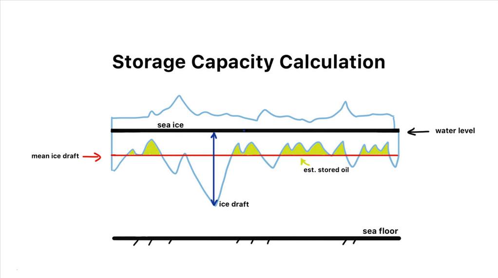
This chart, created by Kelsey, displays how oil might get trapped under ice. (Image courtesy Kelsey Frazier / ADAC)
"If oil was released, say from a well blowout, it would rise to its buoyancy and it would fill in those pockets on the underside of the ice," Tom explained. Oil wouldn't run off laterally to the surface, but would stay corralled in the cavities.
Simply put, said Kelsey, "You tell me what stage [the ice] is, I can tell you a rough estimate of how much oil could possibly be stored underneath."
However, warming oceans means a greater share of Arctic ice now grows and melts in a season. Arctic ice, as a whole, thus has decreasing storage capacity. "As a consequence you're going to have much more spreading of oil," Tom explained.
So the ADAC team also looked at surface spills, determining how oil might move in open water based on the percentage of ice cover. It's a complex series of equations, and that's saying nothing of the cleanup effort, which brings its own separate set of complexities. But thanks to ADAC data, NOAA can now refine its models that formerly only worked in ice-free environments.
"[NOAA] will have the tools to better anticipate how that oil will move and spread when that's happening in an icy environment," Tom explained. "That's the beauty of Kelsey's work - even before any one is out there with a helicopter, in principle, if you knew the volume of the spill, you could already know how big a horizontal area that oil is occupying."
NOAA has already incorporated ADAC data in their preparation modeling. Next, Kelsey and Tom will head to Quebec City to present at the 18th International Conference on Cold Regions Engineering in August. Kelsey has signed up for another two-year ADAC project, this time devising a simple tool for communicating ice conditions, so ship captains can better gauge safety on Arctic routes.
It's another project with immediate applications, especially now that ships can shave days off transit time by skirting ice-free waters of the Arctic.
Born and raised in Alaska, Kelsey has enjoyed research that immediately benefits her community. "I want to make sure that the state not only survives, but thrives," she said of her ADAC experience. "If we don't address how to do things safely in the state, if we don't address some of these really big questions, then we have this information deficit ... I think that sets us up for future problems."
Kelsey's ADAC experience has also contributed to her career. "Working with our partners through ADAC and working with the other research staff really allowed me to see I do have skills and I do have something to contribute, and what I'm contributing is valuable. I think that is one of the biggest benefits," she noted.
"There's so much enthusiasm for what we do and we work with such, not only wonderful people, but world-class individuals at ADAC. I'm really lucky to be where I'm at."

(Image courtesy Brocken Inaglory / Wikimedia Commons)
Written by J. Besl, UAA Office of University Advancement
 "Oil and ice: ADAC engineers prepare for spills in the Arctic" is licensed under a Creative Commons Attribution-NonCommercial 4.0 International License.