


Visualizing the ocean and outdoors with GIS
by Keenan James Britt |

For Prince William Sound College (PWSC) outdoor leadership graduate Frank Schweers, a passion to explore the outdoors led to new opportunities to help others visualize the outdoors through the use of geographic information system (GIS) technology.
Originally from San Antonio, Texas, Schweers took a gap year after completing high school to work as an instructor at the Outdoor School in Marble, Texas. This role gave Schweers experience in educating others on the outdoors: “It’s right on the Colorado River on Lake LBJ…during the off season in the fall and spring time…school groups of elementary and middle school students come out for three or four days and it's all about experiential learning and hands on environmental education.”
Schweers’ passion for the outdoors came bundled with a desire to experience Alaska. “I always wanted to come up to Alaska. I wasn’t always sure what for,” says Schweers. “For a while I just wanted to work at the fishery or something just to get up to Alaska.”
Ultimately, Schweers discovered PWSC through an internet search: “I was really interested in the outdoors, so I was really looking for college programs that focused on outdoor education, and I just looked up the keywords and threw ‘Alaska’ in there, and Prince William Sound College, the outdoor leadership program showed up.”
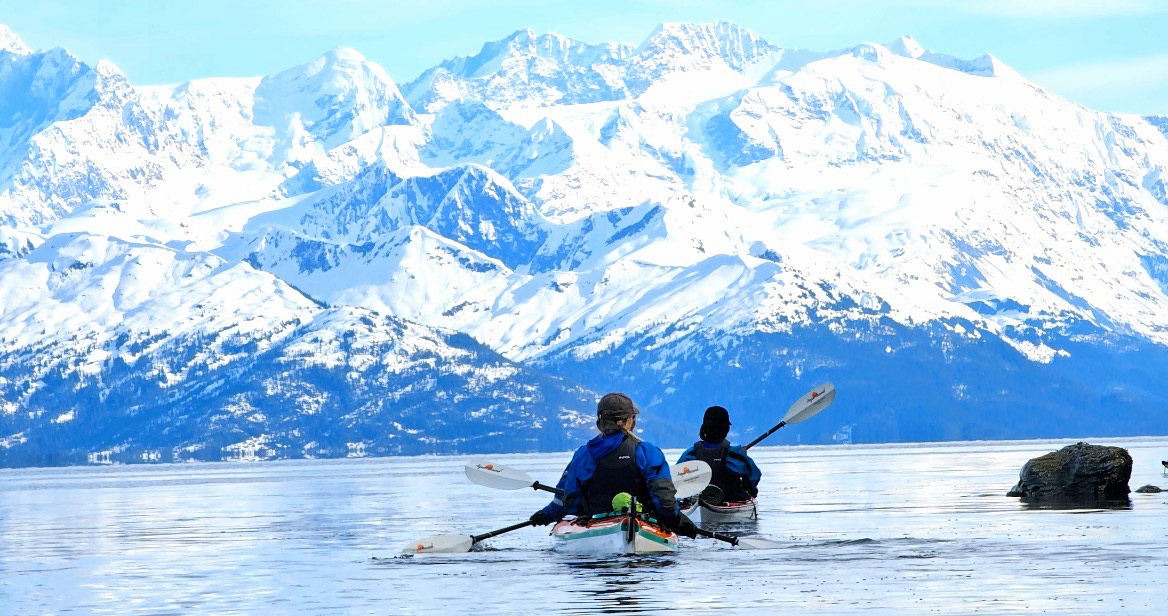
Schweers moved to Valdez and started in PWSC’s outdoor leadership program in fall 2022. “I’ve gotten so much time outdoors, just backpacking and kayaking, that really helped me appreciate Alaska,” says Schweers. However, it was a course inside the classroom that opened new opportunities. Schweers completed PWSC’s Introduction to Geographic Information Systems course in fall 2022: “that was the biggest one…that really inspired me to look into GIS and to take an interest in it.”
The GIS background Schweers gained from the course led to an opportunity to intern with the National Park Service’s Lands and Planning Division at Wrangell-St. Elias National Park during summer 2023. “I just needed an internship for the summer and it worked out and I really enjoyed it,” says Schweers, “They showed me all the interesting stuff in the park. They called me a ‘sponge.’ I was there to absorb stuff.”
Using ArcGIS software, Schweers created maps for use in the park’s projects, ranging from trail maps to maps of moose populations in the park. “I've been working on making maps that use 3D terrain and different kinds of symbology that differ from normal maps by displaying information as how it looks in real life rather than flat shapes and colors,” Schweers said in an interview at the time.
Returning to Valdez for the 2023-24 academic year, Schweers continued to develop his GIS skills through an independent study project under the guidance of Amanda Glazier, Ph.D., assistant professor of biology and environmental science at PWSC. Schweers learned about the opportunity while in Glazier’s environmental sciences course: “She had an independent research grant and I asked if there were any projects I can do related to GIS, and she was able to get something worked out.”
Schweers’ project involved creating maps using data collected by tribal citizen scientists and volunteers with the Chugach Regional Resources Commission (CRRC)’s Alutiiq Pride Marine Institute. Schweers’ maps allow others to visualize the collected data, including ocean temperature, acidity and phytoplankton counts. “I think it’s a really good example of the practical use of GIS, because they have this huge database…it’s really good data, collected across the state of Alaska, and it’s really useful,” says Schweers, “but it might be hard for someone to interpret who’s not a scientist. They can’t just read through that and figure out what the pH of the water means. So the map is a cool way of taking that data and putting it into a form that’s easy to interpret and digest.”
Schweers will continue studying GIS and related technologies at UAA’s Anchorage campus in the fall, pursuing a B.S. in geomatics.
 "Visualizing the ocean and outdoors with GIS" is licensed under a Creative Commons Attribution-NonCommercial 4.0 International License.
Recommended Stories
 Save the date for Welcome Week events kicking off the fall semester
 New Tribal SSBCI business program launched by UAA’s Alaska SBDC
 Michele Yatchmeneff discusses engaging Alaska Native students in STEM on NSF podcast
 UAA's aviation program awarded $50,000 in scholarships from Atlas Air Worldwide
 The adventures of 'Barnacle Boy': Hannah Bogdan reflects on 138.2-mile kayak capstone expedition